Showing posts with label packrafting. Show all posts

Saturday, June 13, 2015

Benjamin Island

In Mid-May we paddled out to Benjamin Island to see the sea lions. We hiked through the woods, surprised at how many wind falls there were and also surprised that someone had left a campfire smoldering. The breeze likely whipped it back up. I got a good chuckle at the new signs posted. It's never my intention to get close enough to a 500 lb animal to feed it. No thank you.


It was a Friday afternoon and so we had the island all to ourselves. A little creepy. A little satisfying. There was no one to make us feel guilty about how much time we spent watching the sea lions. I enjoyed seeing the little pups nursing and the teenagers harassing each other. Mr. X liked the lion with what appeared to be an entire salmon stuck to the side of his face...err looks like you got a little something right there.


There was enough of a cold breeze that we hiked back to east side of the island to eat our sandwiches. Mr. X was impressed with the new benches someone has made. On our paddle back to boulder beach we managed to scare both ourselves and a solitary sea lion. He was minding his own business, diving and playing. Unfortunately our timing was poor because he surfaced about 10 feet from us. We were glad he chose to re-dive immediately. Crossing back to the mainland we had to navigate through some fairly deep waters that also happen to go from protected to less protected. I'll admit the rolling waves made me a little sea-sick and I couldn't enjoy watching the water birds until we got out of the wind tunnel. Then I was pleased to see bonaparte gulls, scoters, and grebes.


Saturday, June 14, 2014

Day 5 - 6: Tenakee Springs


At about 3:00 am Mr. X awoke to find me sitting over him clutching the bear spray. We again heard stamping outside and couldn't decide whether they were deer or bear. I peeked out of the tent but couldn't see anything save beach or trees. Mr. X wanted me to keep still so I wouldn't startle whatever was there. Eventually the noises disappeared and I opened the tent to confirm they had moved on. I turned back to Mr. X and he said, "so you want to go back to sleep?" And I said, "No! I just want to get out of here".

With only 10 miles to go, I hoped we could make it to Tenakee Springs by the afternoon. The wind and waves still looked a bit rough. We decided though to take it easy, try to relax (after that uncomfortable night) and appreciate our vacation. We stayed close to shore and thankfully avoided the bulk of the wind, making decent time. That didn't stop me from humming the song Master the Tempest is Raging, however.

Finally we spotted a cabin, then some more. Finally the main waterfront of Tenakee came into view. At long last the wind was pushing us the way we wanted to go. As we drifted past the ferry dock and then the float plane dock, a man stopped us giving us the low down on Tenakee:  "Uh, you know the ferry's been cancelled, right? You can camp over there by the boat harbor under that shelter. You know about the bath house hours? And the bakery is open." He also asked, "No bear trouble?" We just stared and he answered, "Well, guess not or you wouldn't be here."


We paddled to the boat harbor, hauled out - actually some guy came and helped me because I looked like I was about to fall in, packed the boats and headed to the "surplus area" in Tenakee. Under a metal shelter we found a fire ring, shelves (to hang gear), camp chairs, wood, etc.


We ate lunch and unpacked a few things and then decided to pull everything out and take advantage of the gusting wind to dry our wet gear. A little later we realized we should have talked to the harbor master and gotten his okay to set up in this location. He said it was fine, but I'm thinking we really should have checked with him first.
 Comfrey in front of the bathhouse - one of Mr. X's favorite plants. What fun to find it growing in Tenakee


Tenakee is a place of 50 people with no cars. People have hand carts or four-wheelers and the main drag is named Tenakee Trail.We walked into town and were warmly greeted by everyone. I went to the mercantile (well, their warehouse, the store is under construction) and got marshmallows for roasting, used the public toilet perched over the tide flats, checked out the book exchange and got info on breakfast the next day. We wandered out the forest trail looking for fresh water. We eventually found Tenakee River and a suspension bridge.

The wind was gusting, but the sun was also shining. We found a park bench and sat down to enjoy the warmth on our faces. Never mind that we were still wearing long johns and fleeces. 

In the evening we wandered up to the school. Mr. X thought it was funny that the school is labeled handicap accessible when you have to climb seven flights of stairs to get to it, tucked up on the hillside.

Mr. X took his turn at the hot springs. When the float plane landed in the evening, we headed into town to see if we could change our flight. Alaska Seaplanes took real good care of us. Because the ferry was cancelled and we were a day early, they ordered up a second plane to get us out when we wanted.

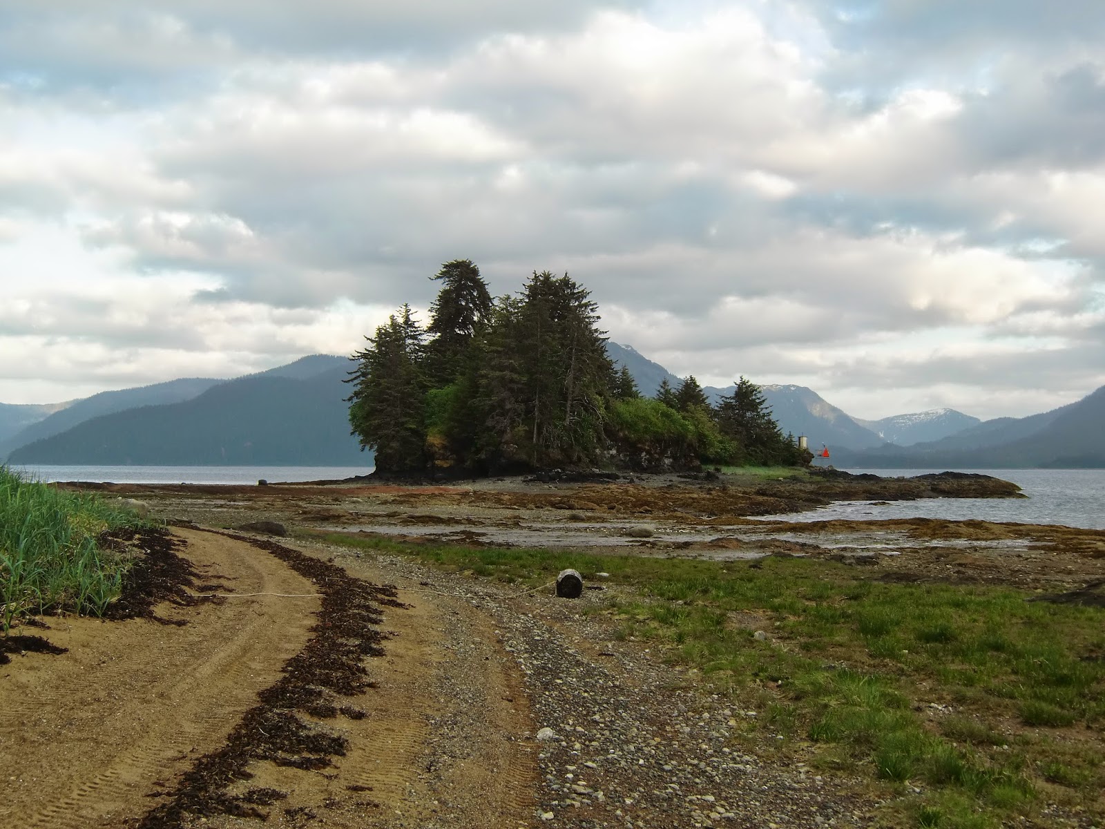
I suggested we go to grave island. When we walked around the beach we were astonished at the beauty that we found. This is why I came here. Look at that meadow and those emerald mountains. Don't you just want to go hike them?

Mr. X went to bed and I took my turn at the bath house. There are separate hours for men and women because this is a no-clothes hot spring. The water was a beautiful crystal clear and incredibly hot. I appreciated the little bit of a breeze coming from the window vents in the ceiling.

After a nice, restful sleep, we finally had a sunny morning. We packed up and headed into town to the bakery for breakfast. Mr. X had pan sized pancakes with sausage, I picked the biscuits and gravy and we shared a cinnamon roll and a rhubarb and strawberry tart. The Party-time Bakery was a lot of fun. We got to see a bunch of artwork that locals make, get introduced to small cruise ship passengers in for the morning and find out about the shamrock building which used to be the dance hall and movie theater. The restaurant owner/chef came out and asked us about pack-rafting. He told us about a guy last year that was doing a major trek and got hurt pack-rafting; a local at a remote cabin found him and ran him in to Tenakee to get him out and to a hospital.

Just steps away from the bakery is Alaska Seaplanes where we went to get checked in and weigh our luggage. A fishing party showed up; they also were disappointed about the ferry and were glad they could hop our plane. They put Mr. X and me in the back on the sling seat. I questioned whether it was because we were the lightweights; Mr. X theorized it was because we stank.

We had a beautiful flight over Freshwater Bay and Admiralty island - including Greens Creek Mine - back to Juneau. The ride was pretty good but we hit a few good bumps crossing Chatham Strait and I wasn't sure how well my breakfast would sit. We roared up and over ridge lines and soared over water before landing on the Juneau seaplane pond. A wonderful trip, but just as wonderful to be home with running water and clean clothes.

Thursday, June 12, 2014

Day 4: Midnight Assault aka the Portage and Tenakee Inlet


 The GPS alarm sounded at 12:30 am and we emerged from a six hour slumber to hurriedly pack up our gear. When we hit the water at 1:20 am I was shocked to see the explosion of light and color in the inky water. We had enough light to make out the mountains, rocks and shoreline, but plenty of dark to appreciate the bioluminescence glittering off our paddles and the wakes of our boats. Suddenly a midnight assault seemed like the only way to do the trip.

We had five miles to go to the portage and wanted to hit the high tide at about 3:30 am. Fortunately, this area is shallow and the water was glassy. The reflections in the water were amazing.

We had a little trouble finding the last pond, simply because 1) we didn't choose to go right enough and 2) with only a 14 foot tide, the portage looked like the shore instead of a marsh. If you stay far to the right, you'll be able to see the break in the trees and find the route to the final pond. We meandered back and forth a little before we found where we needed to go.

Fortunately, we were able to guide or "line" our boats through most of the route, walking beside them. We carried them the last 50 feet and then with packs on our backs paddled across the last pond.

In the middle of the pond I heard a distinct, "Woof, woof". I asked Mr. X if he had heard it. As we landed Mr. X heard a "Woof, oof" and asked me what I thought it was and I said, "A bear, I'm gonna grab the bear spray. HEY BEAR!" But first I had to extricate myself from the ankle deep mud and make sure I still had my shoes. Meanwhile Mr. X is checking his back as he stands on shoreline lavishly spread with bear scat. "YIP-UP" hollered Mr. X and then we shouldered our packs and held our boats by their tube as we traversed the 300 foot portage to Tenakee Inlet, HEY BEAR-ing and YIP-UP-ing every once in a while to give the bear plenty of notice of where we were.

We were at the head of Tenakee Inlet by 4:01 am and finally were looking directly at the mountain Mr. X had dubbed "sugar loaf" that we had admired for the past two days. We also pulled out our no-see-um nets 'cause the midges were biting.

Mr. X then made friends with a group of sea lions who followed us for the next 17 miles.

The going was good and we were enjoying the flat water and falling tide. We followed the shoreline and quickly passed the island on which we planned to eat breakfast. I spotted sea stars that appeared to be more than two feet long. I also watched the languid swimming of jelly fish.  We paddled out to the middle of the inlet, catching the best currents, but finally at about 9 am, we needed to stop for breakfast and I heard water running - always a good idea to get water when you can. As we approached the shore, however, I spotted two rocks that weren't rocks, but instead a sow and 2nd year cub eating greens on the beach. I voted for not going ashore.

Eventually we found another beach on which to eat our blueberry oatmeal.

After another two hours of paddling, it had started to rain and I was getting a little cold. We stopped on a sandy spit and I was wishing and wishing that there was a remote cabin perched just around the corner. We had a lunch of sweet and sour pork and then filtered some water from a stream. A loon landed on the beach and shouted its haunting call across the water. 

By now the tide had turned and was rising. Along with the rain came a bit of wind and the waves were growing. I was starting to get frustrated with how challenging the travel was becoming, and a little scared of the waves. Mr. X took the lead and got me through some white caps. Eventually, I landed on a beach and suggested that we either camp or continue on foot. By now we'd been in "go" mode for more than14 hours and so Mr. X recommended that we skip dinner, and pitch the tent where we were. I agreed and we set to work.

Tenakee inlet has more wildlife than Port Frederick and although we were on the north side which is not known for lots of bears, it still is Chichagof island. We have heard of bears gnawing on packrafts so we dissembled the boats and used them as ground cloth under the tent. Mr. X stashed the bear canister with all food and scented items down the beach and then he climbed a tree and stashed our packs with the rest of our gear including dry suits. And then I turned around and realized that there was a bear trail on the beach and deer scat in the fragrant and soft pea plant around the tent.

By 5:30 we were bedded down and shortly later asleep. I got a nice nap and then the rest of the evening, I heard animal footsteps and crashing waves. At one point I was certain there were at least three deer outside, but later the snuffing and stomping on the beach I convinced myself were bears.

Friday, June 6, 2014

Day 1: Juneau - Hoonah - Midway Island


 After spending all of Memorial day having our chains yanked by the air service, we were hoping our butane and bear spray were ready and waiting for us in Hoonah Tuesday morning. We were all set for our 8:05 flight on Wings, just finishing up those last minute things, when they called us and asked if we still planned on taking the 7:30 flight...it was 7:20 and we hadn't checked in yet. Gulp. We were five minutes from the airport and thankfully after giving our weights and tossing our drybags at them, we were ushered out to our plane, a 9-seater Cessna Caravan.


After a quick 20-minute flight over Auke bay, Admiralty Island, admiring the pollen in the tideline over Colt and Horse Islands, we landed in Hoonah. And hoped that what looked like calm seas in Icy Straits meant smooth waters for us in Port Frederick.


Hoonah is a predominately native community of 800 people.The tradition is that the Huna people relocated from Glacier Bay when the glaciers were advancing. Hoonah means the place where the wind doesn't blow. The town is tucked around the corner from Icy Strait so I believe it.


At the Hoonah airport Collette confirmed that our package had not arrived and reimbursed us our money after Mr. X asked twice and then she asked the Juneau office to hold our gear until we returned.

A taxi dropped us off in front of the hardware store about 40 minutes before they opened. Mr. X waited and I went walking, looking for the tackle shop which was already open. I went in and thankfully the staff person took me right over to the bear spray, but she didn't have an butane and said nobody had ever asked her for it before - she wondered if it was a "new" thing. Not new, I said, must not be popular though.


The hardware store didn't have butane either and at this point Mr. X was wondering if we should just cancel the trip. Fortunately, the trading post had a propane stove and propane, so I said we were going.

We walked down to the boat harbor and found a rest room to enjoy running water for one last time and a place to assemble the rafts. As we inflated them, a coast guard helicopter passed over us and I heard the gasping of what I thought were whales.

Launching into the calm cove, we soon discovered that there were 1 - 2 foot waves and a headwind. All around us there were eagles hunting herring, porpoises diving, and as we passed the log booms at the logging site, a row of cormorants.

We paddled for a few hours and then pulled out on a pebble beach near game point for a chicken salad pita lunch. It was a good rest and we needed it for the rest of the day would be head to the wind. At one point we hauled out  on a sand bar 'cause Mr. X boat seemed to be losing air.

When we spotted grassy rock 1.5 miles away - where we planned to have dinner - we decided to walk on the shore with the boats. I enjoyed seeing the different colored rocks and the crystal clear salt water.


We enjoyed a dinner with seals feeding in front of the rock, porpoises diving while Mr. X did the dinner dishes and a black oyster catcher alarming as we launched from the western shore of the rock. Although we were more than 7 miles from Hoonah we could still see the cruise ships docked at the old cannery.

The waves were crashing and I was just glad to have successfully launched from grassy rock when Mr. X realized he had lost one of his neoprene gloves. We went back to shore and he wandered the rock. I was convinced that the glove was a goner. But just as he was about to give up and put his boat back in, he snatched the glove up off the beach. We had been looking for a green glove the color of algae, but the glove was black side up and we missed it on the rocky beach.


 Chimney rock

 Looking back toward Grassy rock and Hoonah


 hole in the rock on cliffs at Midway Island

After another couple hours of paddling we approached Midway Island. This is where we planned to camp. We floated around the whole island looking for a good place to pitch our tent. Mr. X picked a spot and we hauled out of the water, passing star fish as we climbed up the fairly steep beach. Walking around the campsite, Mr. X discovered a dead bald eagle; needless to say we found a better campsite on the west side of the island rather than the south side.

We saw no sign of bear on the island fortunately and we had a somewhat restful night on a slightly slanted tent site. Early in the morning I heard and explosion. Since we had passed old clear cuts and logging camps I wondered if someone was dynamiting. Later, I decided it was a whale breaching. 

Wednesday, June 4, 2014

Hoonah to Tenakee Springs


Mr. X and I recently returned from a multi-day pack-rafting trip from Hoonah to Tenakee Springs with a short portage. This is billed as a 40 mile paddle, but we paddled quite directly and came up with 50 miles; we must have followed the shore more than that other guy, but that's okay 'cause I was shooting for my pack-rafting merit badge anyway (not really).

Hoonah and Tenakee Springs are on Chichagof Island, one of the ABC islands, which are known to have the highest concentrations of brown bear populations in the world. Most people say that the ratio is 1 bear per square mile, but I have read some people claim that for Chichagof it's 3 bears per square mile. Either way it's alot of bears. At one of the lectures we went to this past winter, the presenter said to think about it this way. How many Starbucks, McDonald's and Subways do you see as you're driving around in the lower 48? That's about what the frequency of bears in the ABC islands. We also learned that some people claim that the bears on the ABC islands are related to polar bears. During the last ice age, a female polar bear did lend her DNA to the bears in the area and their population has been disconnected from mainland bears for the last 40,000 years, but this does not mean that the bears have any unusual hybrid traits. They are browns/grizzlies.

The planning for the trip was fraught with ferry schedule woes, small plane fears, weather worries, bear terror, and cabin booking disappointments. But somehow we managed to listen to Collette at the Hoonah airport and were just fine once we got on the water -- well, mostly. 

Friday, May 16, 2014

Berner's Bay

Saturday we took a long awaited rafting trip.We saw whales, sea lions, seals, an otter, eagles, moose scat, and then we put the boats in the water.

Berner's Bay is billed as one of the most bio-diverse areas of Southeast. There are goats, bears, moose, wolves, sea lions, whales, porpoises, etc., etc.. At the head of the bay is the estuary of three glacier fed rivers - Antler, Lace and Berner - which dump vast quantities of glacial silt and also support the wildlife and spawning grounds for eulichan, a herring-like fish that animals of all kinds love to eat.

We paddled our way up Berner's bay from Echo cove, watching the hundreds of scoters take flight in front of us. I celebrated the bonaparte gulls, Mr. X thought the tiny marbled murrelets were adorable. I was astounded by the cormorant flying by, Mr. X asked if that was a "fraggle bird", yep. A horned grebe. We both were sorry that the seal back-floating peacefully next to us decided we were a threat.

At the half way point we pulled out to take a water break and a sea lion crossed in front of us, then a humpback whale. We then headed back out, clinging to the eastern shore of the bay. Nearly to the mud flats, we saw some rushing waterfalls and stopped to get the breeze thrown off. Mr. X's boat spun around and he said, "Hey, there's the cabin". Sure enough, the Berner's Bay forest service cabin hugs a hill not too far south the mudflats.

We paddled to the flats and hauled out. Finding a dry spot on the white sand we sat down on our own deserted isle for a relaxed lunch in the sun. While we waited for lunch to cook, the outgoing tide lapped gentle waves on the sand, a humpback whale trolled and arctic terns bathed in the sun warmed puddles dissolving into the sand. 

Knowing tide waits for no man, we packed back up, and paddled south to the Berner's Bay cabin for a quick peek. There are some good tenting sites in the trees behind the cabin.

By now the wind had picked up and the tide wasn't really helping us make headway. At the 3.5 mile mark the previously glassy seas grew to 1 - 2 feet and we were bobbing around like rubber duckies. Mr. X's progress reports were depressing and I wondered if we were going to have to take cover on a beach. It was particularly distressing when kayaks in the opposite direction glided by effortlessly (kayak envy anyone?). Then it started raining, which I assure was not in the forecast.

Finally we rounded the last point and pulled out of the water, packed up and hiked to the car, so glad for the two mile extension of the road which saved us another hour of paddling.